


-
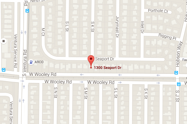
33 BERKELEY ST WEST NEWTON, MA 02465
- Single Family Home / Resale (MLS)

Register to view full details of all properties including foreclosures, Hud Homes and more. View Homes
Property Details for 33 BERKELEY ST, WEST NEWTON, MA 02465
Features
- Price/sqft: $725
- Lot Size: 0.25 acres
- Total Units: 1
- Total Rooms: 10
- Stories: 3
- Roof Type: Asphalt
- Heating: Baseboard, Heat Pump, Natural Gas
- Construction Type: Brick
- Exterior Walls: Wood Siding
Facts
- Year Built: 01/01/1890
- Property ID: 991825980
- MLS Number: 73350828
- Parcel Number: NEWT S:32 B:031 L:0004
- Property Type: Single Family Home
- County: MIDDLESEX
Contact Info for 33 BERKELEY ST, WEST NEWTON, MA 02465
This is NOT a Foreclosure listing. It is a traditional Resale (MLS) listing. Negotiate your purchase with the sellers agent.
Agent(s)
The Gillach Group
William Raveis R. E. & Home Services
William Raveis R. E. & Home Services
Price Information
FirstAmerican Estimates
- Market Value : $2,434,339
- Low Value : $1,885,777
- High Value : $2,982,901
- Confidence Score : 68%
Local Info for 33 BERKELEY ST, WEST NEWTON, MA 02465
Education 02465
- Not High School Graduates 24.46%
- Some College 35.78%
- Bachelor’s Degree 15.23%
- Graduate Degree 7.10%
- Closest Two-year Public College
MA BAY COMMUNITY COLLEGE-WELLESLEY HILLS (3 miles) - Closest Four-year Public College
LASELL COLLEGE (1 miles)
Age 02465
- Infants and Children: 4,151
- Teens: 3,066
- 20 - 39 yrs old: 11,814
- 40 - 59 yrs old: 6,152
- 60 + yrs old: 3,656
Income 02465
02465 - WEST NEWTON, Massachusetts
- Median Per Capita Income: $26,880
- Median Household Income: $156,512
- Average Household Income: $212,138
- Average Individual Income: $79,960
- Income Change Since 2010: $55.44
Massachusetts
- Median Per Capita Income: n/a
- Median Household Income: $85,350
- Average Household Income: $116,837
- Average Individual Income: $46,468
- Income Change Since 2010: $24.67
Crime 02465
02465 - WEST NEWTON, Massachusetts
- Total Crime Risk : 84
- Personal Crime Risk : 123
- Murder Risk : 54
- Rape Risk : 117
- Robbery Risk : 90
- Assault Risk : 137
- Property Crime Risk : 108
- Burglary Risk : 105
- Larceny Risk : 121
- Motor Vehicle Theft Risk : 115
Massachusetts
- Total Crime Risk : 168
- Personal Crime Risk : n/a
- Murder Risk : n/a
- Rape Risk : n/a
- Robbery Risk : n/a
- Assault Risk : n/a
- Property Crime Risk : n/a
- Burglary Risk : n/a
- Larceny Risk : n/a
- Motor Vehicle Theft Risk : n/a
Environment 02465
02465 - WEST NEWTON, Massachusetts
- Average Annual Rainfall : 46.95
- Air Pollution Index : 75.00
- Average July Temperature: (°F) 71.50
- Average July High Temperature: (°F) 82.70
- Average January Temperature: (°F) 25.40
- Average January Low Temperature: (°F) 15.70
Massachusetts
- Average Annual Rainfall : 47.67
- Air Pollution Index : 73.00
- Average July Temperature: (°F) 70.89
- Average July High Temperature: n/a
- Average January Temperature: (°F) 25.55
- Average January Low Temperature: (°F) 16.13
Demographic 02465
Ethnicity
- White: 26,909
- Black: 81
- Indian: 781
- Asian: 343
- Hawaiian: 6
- Other Race: 719
- Hispanic/Latino: 599
Gender
- Male: 47.88%
- Female: 52.12%
Neighborhood 02465
02465 - WEST NEWTON, Massachusetts
- Population: 11,683
- Number of Households: 4,341
- Family Households: 3,170
- Average Family Size: 3.27
- Population Density (persons per square mile): 5,453
- Population Change Since 2010: 1.25%
- Closest Major Airport: General Edward Lawrence Logan International (12 miles)
- Closest Major Sports Team: BOSTON RED SOX (7 miles)
Massachusetts
- Population: 7,056,389
- Number of Households: 2,756,493
- Family Households: 1,736,181
- Average Family Size: 3.21
- Population Density (persons per square mile): 905
- Population Change Since 2010: 7.77%
Real Estate Professional In Your Area
Are you a Real Estate Agent?
Get Premium leads by becoming a UltraForeclosures.com preferred agent for listings in your area

All information provided is deemed reliable, but is not guaranteed and should be independently verified.